

By Sunayana Prabhu
HOLMDEL – While major upgrades on Crawfords Corner Road are almost winding down, Monmouth County officials have now revealed updated plans for another long-anticipated infrastructure project to fix design deficiencies on South Laurel Avenue.
The Monmouth County Board of County Commissioners announced the advancement of a concept development study to enhance safety and mobility along the heavily traveled corridor (County Route 52) between Commons Way and AT&T Drive in Holmdel and Middletown.
The road has several design flaws, particularly at a section of the road that passes beneath the NJ Transit railroad bridge, which has experienced major and frequent crashes, according to county reports.
At the recent second installment of a public information session held online on the county’s website via a prerecorded presentation, County Commissioner Director Thomas Arnone presented updates on the project.
“This is an important infrastructure project that will improve safety, accessibility and overall quality of life for the residents, commuters and businesses in our community,” Arnone said during the Aug. 11 session.
The corridor serves as a vital transportation link, connecting Garden State Parkway Exit 114 with Route 35. While the roadway formerly traversed through farmland, development within the area began in the 1990s and South Laurel Avenue currently provides access to large residential developments: Beau Ridge Condominiums, Cedar Village at Holmdel and Laurel Greene Condominiums, as well as retail destinations including the Commons at Holmdel and commercial developments with the AT&T corporate campus that is spread across both Holmdel and Middletown.
Current Design Problems
The railroad bridge is identified as a particular problem area. It creates hazardous conditions for both vehicles and pedestrians. “Unfortunately, the current condition of South Laurel Avenue under the (North Jersey Coast Line) railroad bridge does not meet modern design standards,” Arnone said.
The road creates “a pinch point,” Arnone said, because of its height, often too low for large trucks, which then strike the bridge. The restricted clearance beneath the bridge also limits visibility and mobility for vehicles, bicycles and pedestrians. Narrow shoulders, a lack of sidewalks and poor sight lines at unsignalized intersections add to these hazards.
According to the presentation, the bridge was hit by over-height trucks 10 times between 2017 and 2019. This year it was hit Feb. 13 and again April 29.
“Not only do the truck hits cause a dan gerous situation to drivers, they result in traffic backed up for miles and major impacts to the local roadways and residents,” the presentation noted.
County officials are now working on options to produce a Preliminary Preferred Alternative (PPA) or redesign options for a nearly 1-mile stretch of the road to minimize environmental, quality of life, access, right-of-way and utility impacts, they said.
Proposed improvements include increasing the vertical clearance under the NJ Transit bridge, removing the existing hourglass configuration, improving pedestrian and bicycle access, addressing the condition and impacts to four culverts that carry unnamed tributaries of Mahoras Brook, and minimizing disruptions to NJ Transit service during construction.
“The project will eliminate the horizontal and vertical deficiencies at the railroad bridge that currently restrict traffic flow and the low clearance that has resulted in many truck strikes over the years,” Arnone said.
Plans to Upgrade Aren’t New
Holmdel Township officials have been working on the project since 2005 and received an $800,000 federal grant under the SAFETEA-LU (Safe, Accountable, Flexible, Efficient Transportation Equity Act: A Legacy for Users) program that authorizes funds for highways, highway safety programs, transit programs and other purposes. But the township determined the project was “too large and complicated to advance,” according to the presentation. Since the NJ Transit bridge spans a county road, the Monmouth County Division of Engineering and Traffic Safety assumed responsibility for administering the federal process to completion.
The New Jersey Department of Transportation has previously stepped in for some repairs. In 2022, NJ Transit replaced part of the bridge after a severe truck strike and plans to replace another section in 2026. While those efforts will improve vertical clearance, the horizontal restriction remains a concern and needs to be rectified.
The county held the first public session for this project in 2023 to identify the needs and concerns of nearby property owners and stakeholders. According to the community survey by county officials, 91% of area residents and businesses had safety concerns and 82% said there was too much traffic. During the recent presentation, officials shared crash data showing the corridor has higher-than-statewide average rates for head-on and fixed-object crashes.
“The county feels strongly that this corridor should support safe access for all users, whether driving, biking, walking or using mobility aids,” Arnone said.
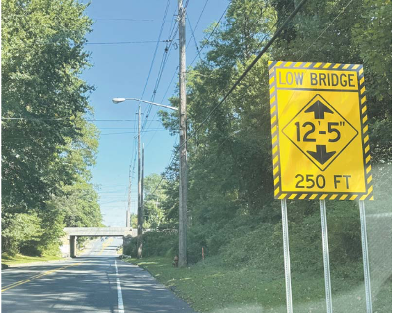
Under the county’s preferred alternative, supported by both Holmdel and Middletown Township as well as NJ Transit officials, the redesigned corridor would include two 11-foot travel lanes in each direction, a 12-foot center turn lane, six-foot shoulders and sidewalks on both sides. The roadway would be lowered, and the bridge widened to provide nearly 15.2 feet of vertical clearance while minimizing disruptions to rail service. The bridge currently has a vertical under clearance of 12 feet, 5 inches.
According to county officials, the planned preferred design aligns with Monmouth County’s Master Plan and Complete Streets policy. Additional goals of the project, besides reducing crashes, include improving pedestrian and cyclist accessibility and repairing four culverts along the route.
Environmental constraints, including streams and wetlands, will be analyzed during the next design phase.
At the end of the concept development phase, officials will decide whether to advance the project into preliminary engineering, final design and construction. Each phase typically lasts 18 to 24 months.
The remaining steps in the current phase include finalizing the preferred alternative based on input from residents and businesses by Sept. 22. The findings will be summarized and presented to determine whether the project can move to preliminary engineering.
“We are committed to improving safety, connectivity and mobility,” Arnone said. “We look forward to working together with our residents, partners and agencies to move this project forward.”
The presentation is available on YouTube and a fact sheet is posted at visitmonmouth.com.
Written comments will be accepted through Sept. 22. Comments may be mailed to: Anthony Sytko, Community Involvement Facilitator, Stokes Creative Group, 3223 Route 38, Suite 201, Mount Laurel, NJ 08054 or emailed to asytko@stokescg.com. For questions about the South Laurel Avenue project, contact Vince Cardone, Monmouth County Project Manager, at Vince.Cardone@co.monmouth.nj.us or 732-431-7760.
The article originally appeared in the August 28 – September 3, 2025 print edition of The Two River Times.


